


Notams Aero provides to the user graphical NOTAM display on map and beside this many other essential information.
Notams Aero contains :
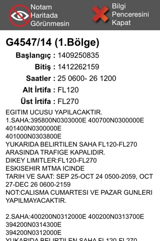
* Warning NOTAMs with graphical interface
* Separated active NOTAM areas with different colors. (Firing, Parachute Jumping, Airshow, Prohibited, Military Activities, Photographing Flights… etc.)
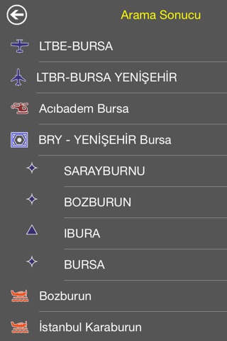
* All airport, heliport and airfield in Europe
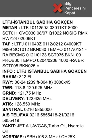
* Airport/Aerodrome meteorological information (METAR & TAF)
* Airport/Aerodrome NOTAMs
* Navaid locations and frequency information
* Prohibited, Restricted, Dangerous, Training, Sporting areas (Static Data)
* TFR (Temporary Flight Restriction Areas), NOTAM Activated Areas
* Enroute waypoints
* Enroute routes (Upper and Lower section). Road designators, road properties.
For more information, privacy policy and terms of use please visit : http://notams.aero
Continued use of GPS running in the background can dramatically decrease battery life.